 |
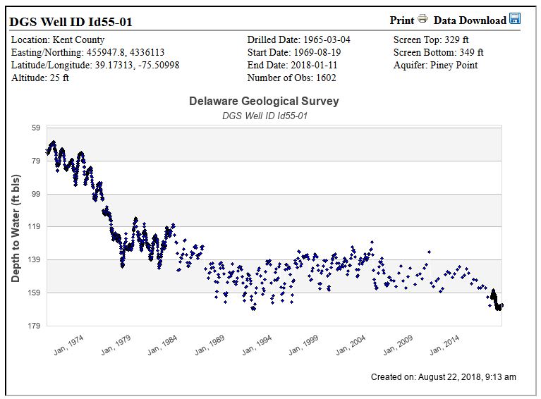
In the table below, click on the chart link to display a hydrograph or the data link to download all observations for the well period of record.
For more details about this data, see Well and Water Level Summary for Wells with 100+ Observations or 20+ Years of Data
Table Heading Descriptions
- Alt - Elevation of land surface in NAVD 1988 feet
- Top, Bottom - Depth to top and bottom of open or screen interval in ft below land surface
- Obs - Number of water level measurements
- Start, End - Start and End dates for the period of record of observations
|
Pocomoke
Columbia
Mt. Laurel
Cheswold
Rancocas
other
multiple categories
No category
|
DGS ID:
Period of Record: -
Aquifer: (Screen: - ft)
Download Data: ( Observations)
|
|
Text Search:
|

 DGS Annual Report of Programs and Activities.